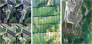
New Leica Photogrammetry Software offers an Evolutionary Process Driven System to Increase Productivity and Accuracy in digital aerial photogrammetry mapping. The comprehensive details of the new release is given below.
Leica Geosystems GIS & Mapping, LLC in Atlanta, Georgia, USA has annaounced the Leica Photogrammetry software, a seamlessly integrated suite of digital photogrammetry products that empowers users to transform raw imagery into reliable data layers required for all digital mapping, GIS analysis and 3D visualization.
“The Leica Photogrammetry Software takes our existing photogrammetry products to a new level while taking into consideration the evolving needs of the market,” said Martin Tremp, Vice President, Business Development & Product Management, Leica Geosystems, GIS & Mapping. “We listened to our customers who said they needed a product that fit into or enhanced their existing workflow, increased their productivity, and was affordable. We’ve responded with a process-driven suite of products that is based on our expertise gained with the creation and support for the ERDAS IMAGINE line and long involvement with SOCET SET sales and support.”
The first version of the Leica Photogrammetry Software will be available in Fall 2003; and the second version is scheduled for release by Spring 2004. The first sneak preview of the Suite will be May 7-9 at ASPRS in Anchorage, Alaska, USA (booth #300), with subsequent demonstrations at the ESRI International User Conference in San Diego in June and at Leica Geosystems’ User Group Meeting in Denver in August.
Created by some of the best engineers in the industry - the same engineers who helped create and develop such industry-leading products as SOCET SET and ERDAS IMAGINE- the Leica Photogrammetry software is made up of Leica Geosystems’ photogrammetry components.
Leica Geosystems’ softcopy photogrammetry product will be available for purchase as an entire unit or in components.
The Photogrammetry Software suite consists of:
• Leica Photogrammetry Suite Core (Core)
• Leica Photogrammetry Suite Stereo (Stereo)
• Leica Photogrammetry Suite Automatic Point Extraction (APM)
• Leica Photogrammetry Suite Aerial Triangulation (AT)
• Leica Photogrammetry Suite Terrain Editor (TE)
• Leica Photogrammetry Suite PRO600 (PRO600)
• Leica Photogrammetry Suite ORIMA (ORIMA)
Customers will save time and money on training to learn to navigate the photogrammetyr software Leica Photogrammetry Suite’s easy-to-use interface; the product’s fast, accurate and scaleable tools will increase user productivity; and users will be able to count on Leica Geosystems’ Technical Support team, the best Technical Support team in the industry, for help on product installation and integration after purchase.
With the Leica Photogrammetry Suite, Leica Geosystems photogrammetry software continues to prove itself as a leader in photogrammetric solutions. Leica Geosystems is the industry leader in providing products that power the Geospatial Imaging Chain of capturing, referencing, measuring, analyzing, and presenting data in a format that is useful to its customers.
For more information about Leica Geosystems GIS & Mapping or its products and services call: +1 404 248 9000, toll free: +1 877 463 7327
Contact Information:
Amber Chambers, ERDAS
Tel.: 770-776-3400
E-mail (press only): Amber.Chambers@erdas.com
General Information: info@erdas.com


